
Hike Springer Mountain. The top is the beginning of the Appalachian Trail from the southern terminus. But day hikers trying to enjoy a nice summit view are also welcome!
| 1.9 Miles Total | |
| Elevation Gain | 393 ft | |
| Trail Address |

Rising to an elevation of 3,782 feet in the picturesque Blue Ridge Mountains of northern Georgia, Springer Mountain holds a special place in the hearts of outdoor enthusiasts. Known as the southern terminus of the Appalachian Trail (AT), Springer Mountain is where many ambitious hikers begin their 2,190-mile journey to Mount Katahdin in Maine. With its sweeping summit views, serene natural beauty, and a sense of historic significance, Springer Mountain is both a destination and a starting point that inspires adventurers year-round.
Springer Mountain Trail
The Appalachian Trail is one of the most famous long-distance hiking trails in the world, stretching across 14 states from Georgia to Maine. Springer Mountain, located in the Chattahoochee National Forest, marks the official start of this epic journey for south-to-north hikers, or “NOBOs” (northbound hikers). It is here, on this unassuming but iconic peak, that countless hikers take their first steps toward completing the trail.
At the summit of Springer Mountain, hikers will find a bronze plaque commemorating the AT and a weatherproof box containing a trail register, where they can sign their names, share their thoughts, and leave encouraging notes for those who follow. This ritual connects hikers to the community of adventurers who have embraced the challenge of the AT, creating a sense of camaraderie and history.
The Summit Experience
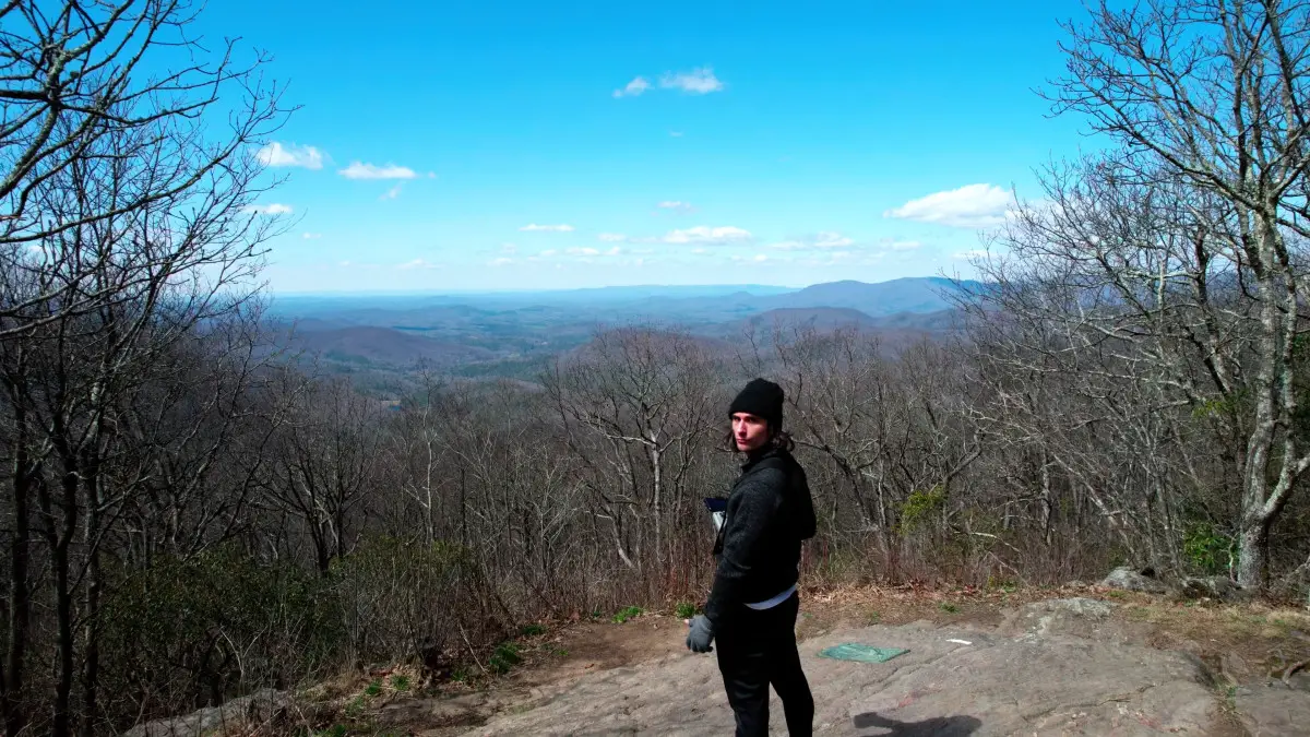
The summit of Springer Mountain offers a modest yet beautiful reward for those who make the hike. From the top, visitors are treated to stunning vistas of the surrounding mountains and forests, particularly in the early morning or at sunset. The view is a testament to the rugged beauty of the Appalachian landscape, with rolling ridges fading into the horizon.
The hike to Springer Mountain’s summit is accessible via a few different routes, the most popular being a 1-mile section of the AT starting from the Springer Mountain parking area at Forest Service Road 42. For those seeking a longer approach, the Amicalola Falls State Park route includes the 8.8-mile Appalachian Approach Trail, which leads hikers from the park’s famous waterfalls to the summit.
The Natural Beauty of Springer Mountain
Springer Mountain is a haven for nature lovers. The surrounding area is rich with biodiversity, featuring towering hardwoods, vibrant wildflowers, and an array of wildlife, from songbirds to white-tailed deer. Depending on the season, hikers might find the forest floor carpeted with trilliums in spring or vibrant hues of red, orange, and yellow in autumn. The trail to the summit winds through a tranquil forest that feels far removed from the bustle of modern life.
The Appalachian Trail Register
One of the most cherished traditions on Springer Mountain is the signing of the Appalachian Trail register. Tucked into a weatherproof box near the summit plaque, the register is a simple notebook that serves as a living record of the hikers who pass through. Each entry tells a story—whether it’s the excitement of a thru-hiker embarking on their journey, a day hiker marveling at the scenery, or a reflective note from someone returning to a favorite spot.
Signing the register is more than just a formality; it’s a symbolic act that ties each individual to the larger Appalachian Trail legacy. For those starting their trek, it’s often the first entry in what will become a deeply personal and transformative adventure.
Hiking trails near Springer Mountain
In case you’re interested in an adventure near the area, check out Long Creek Falls here.